


ECHO Voting District, Maricopa County, Arizona
About
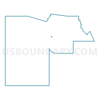
Outline

Summary
| Unique Area Identifier | 524444 |
| Name | ECHO Voting District |
| County | Maricopa County |
| State | Arizona |
| Area (square miles) | 0.58 |
| Land Area (square miles) | 0.58 |
| Water Area (square miles) | 0.00 |
| % of Land Area | 100.00 |
| % of Water Area | 0.00 |
| Latitude of the Internal Point | 33.56151220 |
| Longtitude of the Internal Point | -112.13858200 |
Maps


Graphs
Select a template below for downloading or customizing gragh for ECHO Voting District, Maricopa County, Arizona


Neighbors
Neighoring Voting District (by Name) Neighboring Voting District on the Map
- AUGUSTA Voting District, Maricopa County, AZ
- BELMONT Voting District, Maricopa County, AZ
- CORTEZ Voting District, Maricopa County, AZ
- GOLDEN Voting District, Maricopa County, AZ
- HARMONT Voting District, Maricopa County, AZ
- MANZANITA Voting District, Maricopa County, AZ
- MARIGOLD Voting District, Maricopa County, AZ
Top 10 Neighboring County Subdivision (by Population) Neighboring County Subdivision on the Map
Top 10 Neighboring Place (by Population) Neighboring Place on the Map
Top 10 Neighboring Elementary School District (by Population) Neighboring Elementary School District on the Map
Top 10 Neighboring Secondary School District (by Population) Neighboring Secondary School District on the Map
Top 10 Neighboring State Legislative District Lower Chamber (by Population) Neighboring State Legislative District Lower Chamber on the Map
- State House District 12, AZ (378,298)
- State House District 10, AZ (163,683)
- State House District 15, AZ (155,897)
Top 10 Neighboring State Legislative District Upper Chamber (by Population) Neighboring State Legislative District Upper Chamber on the Map
- State Senate District 12, AZ (378,298)
- State Senate District 10, AZ (163,683)
- State Senate District 15, AZ (155,897)
Top 10 Neighboring 111th Congressional District (by Population) Neighboring 111th Congressional District on the Map
Top 10 Neighboring Census Tract (by Population) Neighboring Census Tract on the Map
- Census Tract 1058, Maricopa County, AZ (6,298)
- Census Tract 1056.02, Maricopa County, AZ (5,943)
- Census Tract 1042.05, Maricopa County, AZ (5,156)
- Census Tract 1059, Maricopa County, AZ (4,956)
- Census Tract 1042.06, Maricopa County, AZ (3,813)
- Census Tract 1057.02, Maricopa County, AZ (3,775)
- Census Tract 1057.01, Maricopa County, AZ (3,426)